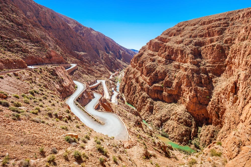
Dades Gorges
Dades Gorges
Between Boumalne Dades and M'semrir, the Dades Gorges unfold four series of canyons carved over 200 km through rocks dating back 200 million years.
The Dades Gorges cut into the northern flank of the High Atlas in Morocco, between Boumalne Dades and M'semrir, in the Souss-Massa-Drâa region. Over nearly 200 kilometers, the Dades River has carved four series of gorges with cliffs reaching up to 500 meters in height, revealing a geological cross-section dating back to the Jurassic period. The site combines ochre and red mineral landscapes, oases of fig and date palms, troglodytic Berber villages, and earthen kasbahs.
Why visit the Dades Gorges
Three compelling reasons warrant a detour to the Dades Gorges:
- An exceptional geological reading: the walls expose Jurassic reef limestones, Cretaceous red sandstones, and Eocene marls—nearly 200 million years of history visible to the naked eye.
- An inhabited landscape: troglodytic houses still occupied, terraced cultivation of fig trees, date palms, and almond trees along the wadi, restored kasbahs such as Kasbah Amridil.
- A geographical turning point: the gorges link the Dades valley to the lake plateau and the Todgha valley, making them a logical stop on a great southern itinerary.
A formation 200 million years old
During the Jurassic era, the area corresponding to the present-day High Atlas lay beneath the sea. Coral reefs developed there, and their sediments gradually transformed into limestones and sandstones. Tectonic movements resulting from the collision of the African and Eurasian plates subsequently lifted these layers, forming the High Atlas range and raising the ancient reefs to altitudes exceeding 1,500 meters.
The Dades River completed the work. Flowing toward the southwest, it carved through the rock over nearly 200 kilometers, exploiting fractures and softer layers to create a canyon in several sections. Winter erosion, temperature fluctuations, and seasonal floods continue to shape the landscape today.
What to see in the Dades Gorges
The four series of gorges
The canyon does not present itself as a continuous passage but as a succession of four distinct sections, separated by more open basins.
- First series: two branches of the river have carved gorges approximately 300 meters deep into ochre limestones from the Middle Jurassic.
- Second series: after the M'semrir basin, a narrow passage roughly 400 meters deep stretches for over 500 meters in length.
- Third series: carved into ochre to reddish reef limestones from the Lower Jurassic, it extends for several kilometers.
- Fourth series: north of the Boumalne oasis, Cretaceous and Eocene rocks alternate between limestones, red sandstones, and marls, with varied erosion formations.
The Monkey Fingers of Tamlalt
Approximately 9 kilometers beyond Boumalne Dades, the hamlet of Tamlalt is dominated by rocky peaks eroded into closely packed columns, nicknamed the "Monkey Fingers." The raking light of late afternoon accentuates their relief.
Berber villages and troglodytic houses
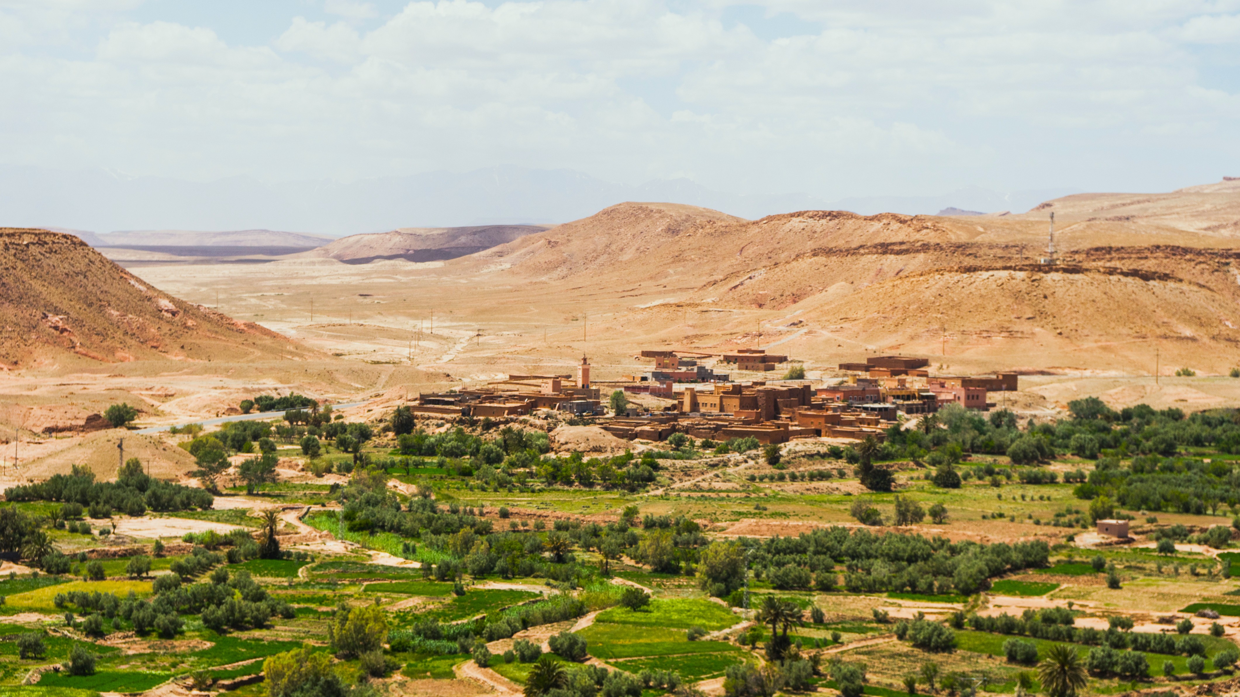
The village of Aït Oudinar, accessible in approximately 3 hours 30 minutes of walking along the Dades, and that of M'Semrir, about 60 kilometers north of Boumalne, offer insight into life in the high valley. Several dwellings are carved directly into the rock and remain occupied by their owners.
Kasbah Amridil and Timzzilite viewpoint
Kasbah Amridil, dating from the 17th century and regularly restored, remains one of the most complete earthen architectures in southern Morocco. Higher up on the road, the Timzzilite overlook dominates the spectacular hairpin turns descending toward the valley floor. The Imdiazen defile, a narrow canyon downstream, completes the visit for those who appreciate mineral landscapes.
Practical information
- Duration of visit: allow a half-day to drive the scenic route, one to two days to include a hike to Aït Oudinar or M'Semrir.
- Level: asphalt road up to M'Semrir, accessible by standard vehicle. Beyond, toward Agoudal, the track requires a 4x4.
- Equipment: hiking shoes, water, warm clothing at altitude (evenings are cool even in summer).
- Accommodation: guesthouses and Berber hostels line the road, mainly between Aït Oudinar and M'Semrir. Reservation recommended during high season.
- Fees: access to the site is free. Budget for a local guide if you wish to explore lateral trails.
When to visit the Dades Gorges
The climate is semi-arid, with cold winters and dry summers. The best period runs from April to November, when daytime temperatures remain comfortable and secondary tracks are passable.
- Spring (April–June): almond and rose blossoms in the neighboring valley, mild temperatures.
- Summer (July–August): hot days in the lower valley but cool nights at altitude, higher visitor traffic.
- Autumn (September–November): date and fig harvests, ideal light for photography.
- Winter (December–March): snow possible at higher elevations, some tracks closed, highly contrasting landscapes.
How to reach the Dades Gorges
From Boumalne Dades or M'Semrir
Boumalne Dades is the most practical entry point. Shared taxis depart from the center toward valley villages. Renting a vehicle remains the most flexible solution for stopping at viewpoints. The Agoudal–M'Semrir road, which extends the canyon northward, is passable only by 4x4.
From Marrakech or Ouarzazate
From Marrakech, allow a full day's drive via Ouarzazate and the Dades valley. From Ouarzazate, the journey is shorter and allows you to continue to the Valley of Roses or the Todgha Gorges. Long-distance buses and shared taxis serve Boumalne Dades daily.
To combine with the Dades Gorges
The site's position, halfway between Marrakech and the desert, lends itself to a combined itinerary with other Moroccan stops:
- The Ben Youssef medersa in Marrakech, a classic starting point before crossing the Atlas.
- The Bahia Palace, another major highlight of Marrakech's heritage.
- The Bou Inania medersa in Fez, to continue exploring Merinid architecture.
- The Attiq Waterfalls, a natural alternative in the Middle Atlas.
- The Bou Jerif Fort, a stop on the great southern route for itineraries extending toward the Atlantic.
Frequently asked questions
Frequently asked questions
A half-day is sufficient to drive the scenic route between Boumalne Dades and M'Semrir by car. To include a hike to Aït Oudinar or a detour to the Monkey Fingers, allow one to two days with an overnight stay.
No, the main road is asphalt up to M'Semrir and accessible by standard vehicle. A 4x4 becomes essential beyond this point, on the track joining Agoudal and the lake plateau.
April to November, when temperatures are mild and tracks are passable. Spring and autumn offer the best light and crowd conditions.
Kasbah Amridil, the Timzzilite viewpoint, the rocky peaks of the Monkey Fingers at Tamlalt, the Imdiazen defile, and the Berber village of M'Semrir are the main stops. The neighboring Todgha valley logically extends the visit.
Yes, several trails run along the Dades wadi, notably toward Aït Oudinar (approximately 3 hours 30 minutes of walking). Donkey excursions and nomadic camp bivouacs are also organized from Aït Arbi.
Include the Dades Gorges in your trip
The Dades Gorges fit naturally into a great southern circuit connecting Marrakech, Ouarzazate, the Valley of Roses, and the desert. To build a tailor-made itinerary suited to your pace and the season, explore our Morocco travel suggestions.
Interested in this visit?
We can include it in your personalised itinerary.